
Dramatic aerial displays
The Mach Loop is a series of valleys forming a circular flying route that is used for low level flight training. It is located between Dolegllau and Machynlleth. Also known as the Machynlleth Loop, the Mach Loop lies within the UK’s Low Flying Area 7 (LFA7). To the sout of the Mach Loop, Tactical Training Area 7T sees aircraft flying as low as 30.5 metres. The Royal Air Force publish a timetable of when the areas could be in use, However this is generally an unreliable source of information. Flights take place Monday – Friday and not at weekends or on bank holidays. The Mach Loop attracts many aircraft enthusiasts from around the world who love to watch the drama of planes swooping through the valleys. But it’s a bit hit and miss as to whether you will see anything.
Since 2018, activity at the Mach Loop has been reduced. The RAF frontline squadrons operating Typhoon and F-35Bs have not been flying the Loop. In addition to this, all non-UK based aircraft are prohibited from using the Loop unless part of a UK exercise.
If you are visiting Dolgellau, Barmouth, Machynlleth, the Corris Craft Centre or Cader Idris, you might get lucky and find yourself treated to a special display. The slopes of Cader Idris provide numerous excellent viewing points and so if you are hiking up the mountain, you might benefit from a little entertainment along the way!

Which aircraft fly the Mach Loop?
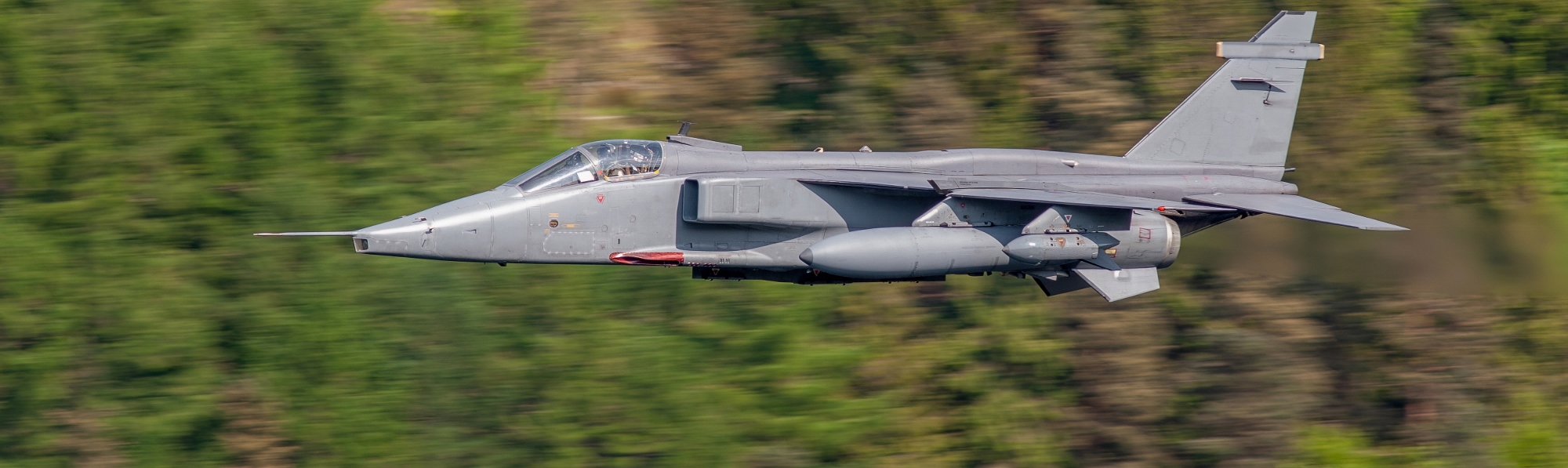
You never know what you might see flying around the Mach Loop. You could be treated to flypasts from several different aircraft but, on the other hand, you may see nothing at all! The following aircraft have all been viewed in the area:
Airbus A400M (Royal Air Force)
Hawk (Royal Air Force)
C-130J Super Hercules (Royal Air Force)
Short Tucano (Royal Air Force)
F15C Eagles (US Air Force)
F15E Strike Eagles (US Air Force)
MC-130 (US Air Force)
V-22 Osprey (US Air Force)
F-22 Raptors (US Air Force)
F-35A (US Air Force)
F-16 Fighting Falcons (Belgian Air Component)
De Havilland Vampire

Aircraft fly around the Mach Loop at speeds of up to 500mph. There are several spots that provide particularly excellent viewing points including those known as Corris Corner, Cad East and Cad West (see map above) which all afford amazing views views down the valley from high points on the hills.
Low flying is an essential skill for military pilots. It is practised between 100 feet and 250 feet; a representative altitude at which pilots would fly in combat scenarios.
If you visit the Mach Loop and don’t see any aircraft, try flying it yourself! It is possible to fly the Mach Loop using a flight simulator. Try Microsoft’s Flight Simulator platform, launched in 2020 or the FlightGear flight simulator, created by the FGUK community.

Where else can you see military aircraft in flight?
If you don’t wish to drive down to the Mach Loop, it is possible to see military aircraft elsewhere. Dinas Dinlle beach is a good place to start as it is adjacent to Caernarfon Airport. Chinook helicopters are relatively common sights and the beach is great place to view F15s on their way from Anglesey to the Mach Loop. The area around Rhyd Ddu, including Beddgelert Forest, is also worth visiting as F15s and RAF Texan T1s often fly up the valley, usually late in the afternoon.
Directions
There are two good places to head for if you wish to park up and wait for the aerial action – The Dol Idris car park and the Corris Craft Centre. From the Woollen Mill, head to the A487 and follow this road south past Porthmadog. You will pass under a red metal bridge and then arrive at a roundabout where you turn left towards Penrhyndeudraeth. Stay on this road which becomes the A470 until after Dolgellau and then turn right onto the A487 at The Cross Foxes Inn. After four miles you will see the Dol Idris car park on your right. Alternatively, continue on the same road for a further three miles and park at the Corris Craft Centre.